USA, Mississippi Wing
Mississippi Delta
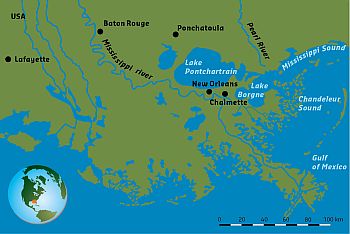 |
The Mississippi River drains a basin of some 3 million km2, which encompasses a substantial part of the United States of America. The basin extends from the Rocky Mountains in the West, to Canada in the North and the Appalachian Mountains in the East. The discharge of the Mississippi accounts for 90% of the freshwater inflow into the Gulf of Mexico. The Mississippi Delta region comprises much of coastal Louisiana and adjacent Mississippi, and includes the metropolitan area of New Orleans. |
>> Read more
Coordinator
Robert Twilley, Louisiana Sea Grant College Program - rtwilley(at)lsu.edu
Publications
Publication: Anatomy of Mississippi Delta growth and its implications for coastal restoration
The best solution to sustaining portions of the Mississippi Delta may be river diversions that bring sediment to shrinking coastlines. However, a new study concludes that the rate of land-building will likely be dwarfed by the rate of wetland loss.
Reference: Anatomy of Mississippi Delta growth and its implications for coastal restoration, Elizabeth L. Chamberlain,Torbjörn E. Törnqvist (Tulane University), Zhixiong Shen (Coastal Carolina University), Barbara Mauz (University of Liverpool, Liverpool, University of Salzburg), Jakob Wallinga (WUR), Science Advances 11 Apr 2018: Vol. 4, no. 4, eaar4740, DOI: 10.1126/sciadv.aar4740
Science Advances
>> Read more
Friday 11 May 2018