WaterGuide Agriculture
Purpose of the tool
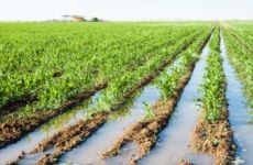
The result of the WaterGuide agriculture is a quantification of crop yield response to drought, O2-stress or salinity. This information helps water management and other governments or policy makers to know the impact on agriculture by hydrological measures. The tool is under construction.
Target group: Water managers, waterboards, provinces, consultancy
Tool description
The WaterGuide is based on simulation models for agrohydrology and crop growth (SWAP-WOFOST), linked to agricultural economic expertise as well as agronomy.
The project that develops the WaterGuide Agriculture aims at three tools:
- Simple tool for end users
- Simulation models on agrohydrology and crop growth for experienced users / research
- Same as 2 combined with a economic decision support system
Result description
<information will follow later>
The tool in practice
<information will follow later>
Necessary inputs and conditions
For the simple tool information is needed on soil and groundwater and the crop that is grown. This will then result in a annual average percentage yield loss related to dry, wet or salt field conditions.
The modelling tools require a lot more input data. E.g. SWAP and WOFOST (see websites)
Contact data
Alterra, Wageningen UR. Joop Kroes joop.kroes(at)wur.nl
Phase and tool category: Problem analysis & Strategy Development and Planning | Physical model
Spatial scale and time scale
Spatial scale: soil pedon; applicable to a soil map and then the soil map can be a region or country.
The agronomic context is Northern-European.
Time scale simple tool: annual averages
Time scale simulation models: day
Tool availability
In due time all free online.
Website: Waterwijzer.nl (in Dutch)