Waterwise for freshwater allocation in a river basin
Purpose of the tool
Waterwise is a model approach suggesting land and water management options for improving water availability and food security. It can facilitate choices between different (adaptation) options, taking into account the wider impact on water resources within a basin.
Target group: Policy advisors, governments
Tool description
In many regions in the world both land and water resources are under increasing stress. It is against this backdrop that scientists at Wageningen UR developed a novel approach to assess where and how food production can be increased and whether food self-sufficiency can be realistically achieved or maintained for basins like the Nile Basin and the Ganges-Brahmaputra Basin. WaterWise comprises a hydro-economic model developed by Wageningen UR that integrates yields from both rainfed and irrigated agriculture in combination with the yield from hydropower. With this tool various food self-sufficiency and regional cooperation scenarios for river basins can be explored.
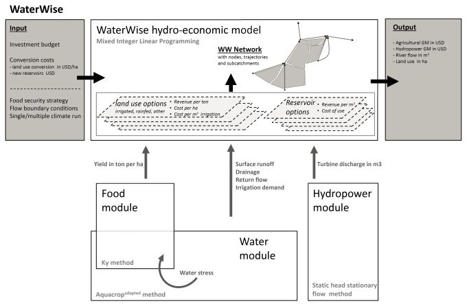
A simplified representation of the Water Wise model, including its sub-modules of water, food
and energy. Depending on the application these modules can be replaced by existing models,
like LPJmL for water and food production input.
So far, the scenarios include the possibility for national food self-sufficiency, individual states or upstream countries developing their irrigated agriculture potential to the maximum, and regional cooperation to ensure that food and hydropower are produced where it is most cost effective. The model consists of three modules on water flows, crop production and hydropower and an optimisation routine to select the most suitable land use and hydropower options, given a certain level of investment. The latest data on soils, land use and crop production, including the costs and benefits of each crop production type, were used to calibrate and validate the model.
Result description
The modelling system 'Waterwise' attempts to provide an alternative to conventional simulation models largely based on trial and error. Conventional simulation models can be used for answering questions of the type: 'What is the effect of a water harvesting structure on downstream flow?' The inverse question would be: 'Where should I construct water harvesting structure to get an optimum production given available water resources?' Waterwise can answer such questions and at the same take various types of preferences into account.
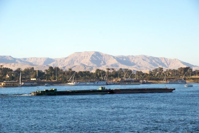
Nile barge transporting food: Water Wise results show that rainfed production in upstream areas of Nile Basin will
be essential to reach food self-sufficiency in the Basin. Developing more irrigation along the Nile will mainly shift production and negatively affect hydropower production. Source: Wikipedia.
The tool in practice
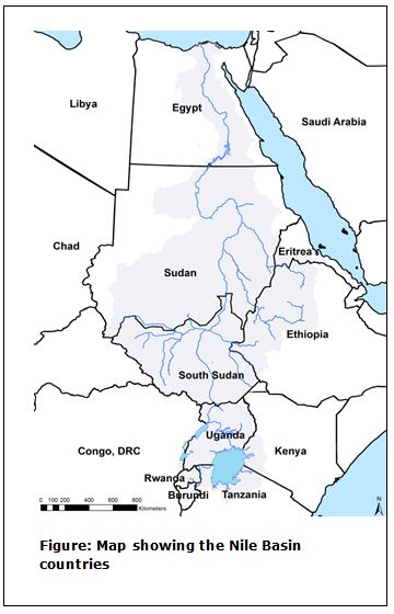
WaterWise is applied in a variety of case studies from regional optimization of land use and nutrient management in the Netherlands to optimal land and water management for water and food security in the Nile and Ganges-Brahmaputra Basins.
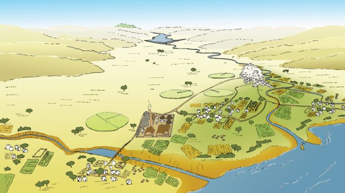
Visualisation of the Nile delta
Necessary inputs and conditions
The user provides information about the available land and water management options, reservoir options, possible extra links in the river network, available capital for investment, and the food security strategy that is to be followed. The model for the soil-water-plant-atmosphere simulation uses output data from an external model that has been run in a pre-processing phase. This gives flexibility with respect to the used model concept.
Contact data
Institute: Alterra, Wageningen UR
Offical project name: Beta Gamma Integration
- Paul van Walsum paul.vanwalsum(at)wur.nl
- Christian Siderius christian.siderius(at)wur.nl
Phase and tool category: Strategy Development and Planning | Physical model
Spatial scale and time scale
Spatial scale of river basins, small or as large as the Nile. The model is run for number of years (3-10) in a continuous simulation so that the investments suggested by the model are based on a variety of weather conditions.
Tool availability
The source code is available; running the model requires a proprietary license for the used mathematical programming software (FICO-Xpress). An analysis can be obtained through the contact persons.
Website: Waterwijs