Jakarta Climate Adaptation Tools
The overarching goal of the project is to contribute to the development of tools to assess, compare, and optimise options for climate adaptation of Jakarta as a Delta City. One tool will primarily be developed from a modelling background and aims at developing flood risk maps that give insights in the spatial distribution of risks as a function of hazards, exposure, and vulnerability. It sheds light on the effectiveness of flood risk reduction measures. Closely related, the research will develop a model to compare and optimise the costs and benefits of (combinations of) measures. Examples of adaptation options to be assessed with these models are forestation in the upper catchment areas, early warning systems, spatial zoning, drinking water reservoirs, and various options for coastal defence.
The main phase of the project Jakarta Climate Adaptation Tools (JCAT) was officially launched in Summer 2011. In this project, two Indonesian researchers are carrying out research to address problems related to flood risk management, climate change adaptation and spatial planning in the city of Jakarta. JCAT will be carried out under the flag of the International Delta Alliance and Delta Alliance Indonesia Wing, within the programmatic framework of Knowledge for Climate.
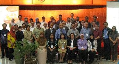
The research consortium consists of VU University Amsterdam, Gadjah Mada University Yogyakarta, Wageningen UR, and Bogor Agricultural University. The research will be carried out in close collaboration with LIPI (The Indonesian Institute of Sciences) and stakeholders in Jakarta. A definition workshop was held in Jakarta in 18 January 2011.
For more information on the project Jakarta Climate Adaptation Tools, please contact the project leader, Dr. Philip Ward (philip.ward(at)ivm.vu.nl).
Activities and Deliverables
Final Report: Jakarta Climate Adaptation Tools (JCAT)![]()
This final report (Delta Alliance report number 8) provides an overview of the different activities, methods, and tools carried out in the JCAT project. This project has contributed to knowledge and capacity building in three main ways: through education, workshops and joint research with stakeholders, and scientific research (KfC HSINT02a project). P.J. Ward, E.C. van Ierland, Y. Budiyono, P. Wijayanti, S. Muis, M.A. Marfai, Poerbandono, M.M. Julian, A. Fauzi.
Final workshop
On 21st August 2014, the JCAT consortium held its final workshop in Jakarta. The title and main theme of the workshop was Jakarta Climate Adaptation Tools: The Pathway to City Resiliency. The workshop was jointly organised by JCAT, the Jakarta Research Council (Dewan Riset Daerah DKI Jakarta; DRD) and the Indonesia International Institute for Urban Resilience and Infrastructure (i3URI). Several other partners and key institutions also supported the workshop, including the Delta Alliance Indonesia Wing. Read more.
Costs and benefits of flood risk adaptation in Jakarta
Since November 2013, Pini Wijayanti has been working at the Environmental Economics and Natural Resources Group at Wageningen University in the Netherlands to two papers. Her first paper focuses on the economic setting of flooding issues; particularly it provides an economic model on how to select the optimal level of flood protection measures. Based on the literature, the paper starts by describing the conditions of flooding in Jakarta, the causes and the options of flood protection measures. Then, it focuses on constructing an economic model to select the level of single or combined flood protection measures that minimize the total cost of measures. Furthermore, the model considers the spatial issues (i.e. from upstream to downstream catchment areas) of Jakarta and the temporal issues (i.e. time horizon on developing and utilizing) of the measures. The results of this model will be available in the coming weeks.
Also, a study is being carried out at the local scale to estimate river flood damage based on interviews with local people. The results of this study will be compared to those from the GIS-based spatial flood risk model mentioned above. This research is a collaboration paper between Pini Wijayanti and Yus Budiono, the two PhD candidates working on the JCAT project. Pini estimates the flood damage by carrying out interviews in residential and business areas along Pesanggrahan River, and constructing an economic model of flood damage based on survey data; while Yus estimates the flood damage based on the results of the flood risk model. This will serve as a useful validation for the two approaches, and will be completed in the coming months.
Other research output
Next to the above research activities, the project has achieved the following highlights:
- A chapter on flood risk in Jakarta in Munich Re’s flagship publication 'Severe weather in Eastern Asia':
- A chapter on flood risk in Jakarta for a planned book on adaptation to climate change in coastal cities (planned for publication shortly)
- Presenting results at the EEPSEA annual meeting in Penang (May 2013).
The 5th AMCDRR conference had the theme 'Strengthening Local Capacity for Disaster Risk Reduction'
In October 2012, the Jakarta Climate Adaptation Tools (JCAT) team co-organised a session at the 5th Asian Ministerial Conference on Disaster Risk Reduction (AMCDRR) in Yogyakarta, Indonesia.
Flood risk model for Jakarta
JCAT has now completed the development of a GIS-based spatial flood risk model 'Damagescanner' for the entire city of Jakarta. Damagescanner takes flood hazard inundation maps developed by several parties in Jakarta, and uses these to estimate economic damages at a spatial scale of 100m x 100m for different flood severities. The model also estimates “annual expected damages”, which are extremely useful for flood risk based decision making. So far, the model has been used to estimates flood risk under current condition (i.e. to derive a risk baseline). Under these baseline conditions, the model estimates annual expected damages of approximately USD 321 million per year. We also examined the sensitivity of flood risk assessments to the use of different vulnerability curves – the use of different vulnerability functions leads to very different results. This means that it is important to develop an understanding of vulnerability at the city level, which is exactly what has been carried out in this project, by holding a series of workshops with multiple stakeholders from Jakarta.
The model setup and these results are currently in review for an academic journal, and we look forward to being able to share this with you in the future. In the meantime, the risk model is now being used to project potential changes in flood risk in the future due to: climate change; land subsidence; land use change; and socioeconomic development. Most of these simulations have been carried out, and the rest will be finished in the coming few months – we look forward to presenting you the results!
Definiton workshop
On January 18, 2011 a definition workshop took place in Jakarta to develop the joint research programme 'Jakarta Climate Adaptation Tools'. A report following the definition workshop can be found here.
Kick-off meeting
On 28 September 2010, a kick-off meeting of the definition phase of the project was organized in Rotterdam. Representatives from several institutions presented the project. Particular attention was paid to the two PhD topics and the planning of the project.